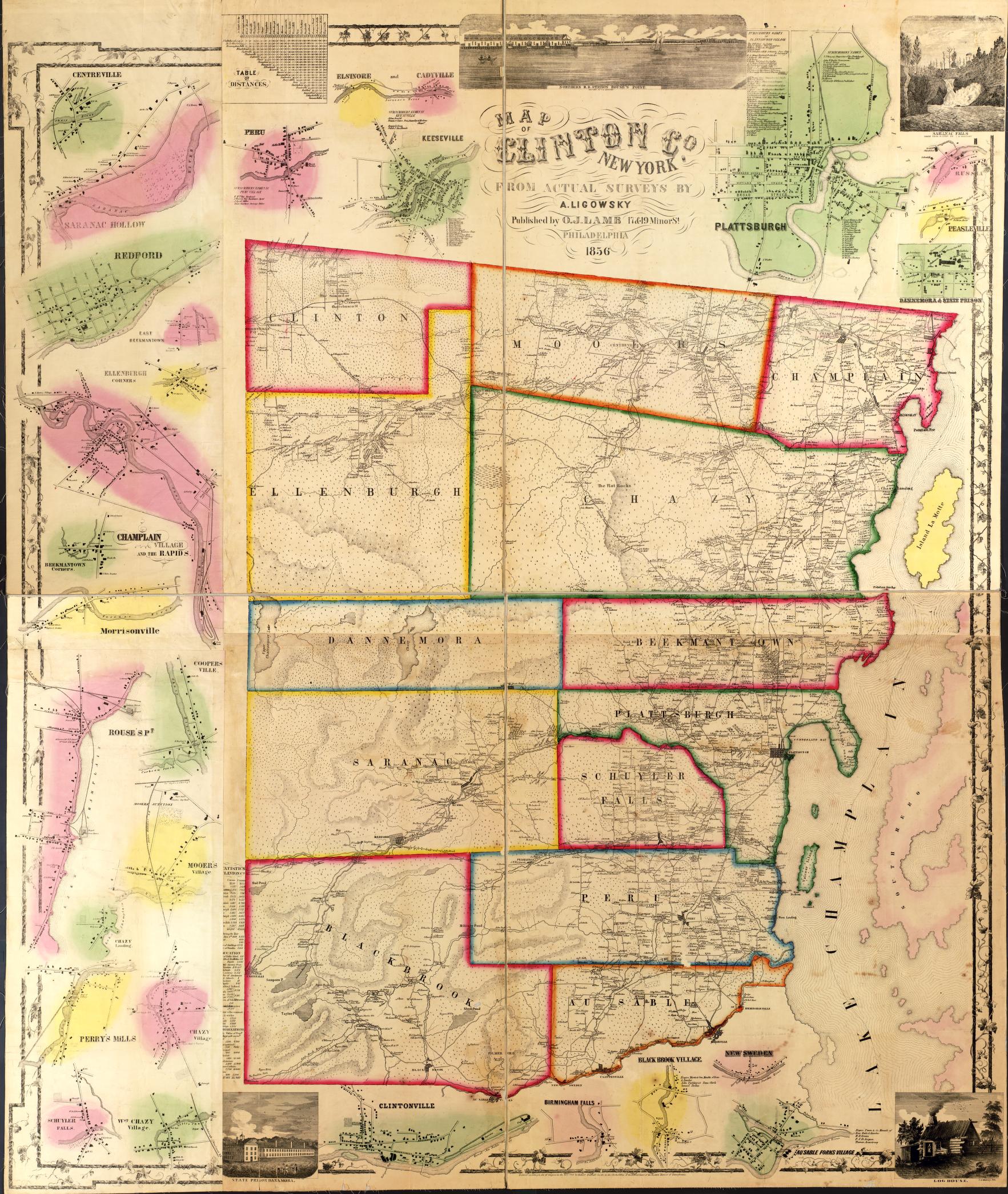
This 1856 map of Clinton County, NY, is the earliest known map of the full county. A preserved cloth copy hangs in the Historian's Office, but, thankfully, the Library of Congress has digitized the map for easier viewing.
Clinton County - Founded in 1788
Altona - Settled in 1800, town officially created in 1857
AuSable - Settled in 1787, town officially created in 1839
Beekmantown - Settled in 1783, town officially created in 1820
Black Brook - Settled around 1825, town officially created in1839
Champlain
- Town - Settled in 1788, town officially created in 1788
- Village
Chazy - Settled in 1790, town officially created in1804
Clinton - Settled around1817, town officially created in 1845
Dannemora
- Town - Settled in 1836, town officially created in 1854
- Village
Ellenburg - Settled in 1803, town officially created in 1830
Mooers - Settled in 1796, town officially created in 1804
Peru - Settled around 1792, town officially created in 1792
Plattsburgh
- City - Settled in 1785, village officially created in 1815 and became a city in 1902
- Town - Settled in 1785, town officially created in 1785
Rouses Point (village) - Settled in 1783
Saranac - Settled in 1802, town officially created in 1824
Schuyler Falls - Settled in 1794, town officially created in 1848